Walk 1: Water, Road and Rail
Start at the Weir – coping with the river
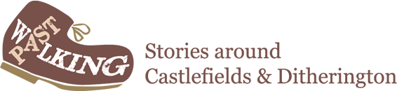
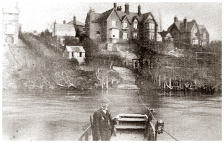
Construction of The Weir, 1910
Up and down the River Severn in Shropshire, there is historical and archaeological evidence of small scale weirs created for fishing. The substantial weir here in Castlefields was built between 1910 and 1911 and was designed to raise the level of the river passing through the town, especially in the summer. The River Severn was in many ways treated as a main drain and, as the water level dropped, waste of all descriptions and odours was exposed. There were also stories that Shrewsbury School joined local rowing clubs and lobbied heartily for a weir so that their summer rowing season was not impaired.
The complaints over many years eventually led to the controversial decision being taken to build a weir. The original design featured a special wooden ramp for small or flat bottomed boats and provision for salmon to be able to make their way up and down stream.
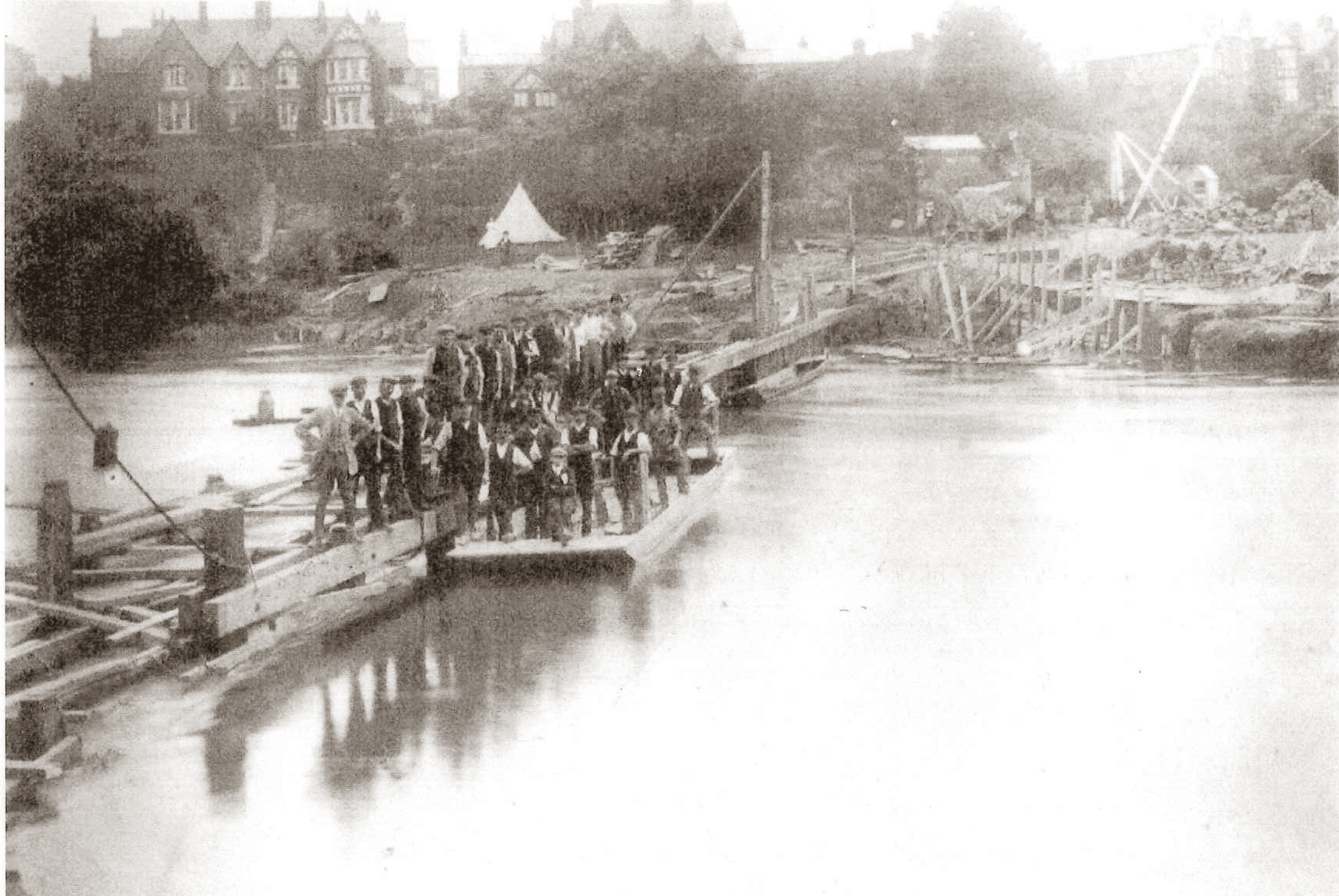
Construction of The Weir, 1911
During the course of construction the project suffered at least one major setback when unexpected flooding washed away unfinished foundations.
Over the years the weir has been modified and altered in various ways with a major reconstruction taking place in 1972. An initial repair using a plastic sheet was a complete failure. There is now no means of taking boats past the weir other than by carrying them or, in the case of intrepid descending kayakers, by ‘shooting the rapids’. Most recently, the Environment Agency has installed improved salmon leaps after the previous ones proved to be easily blocked.
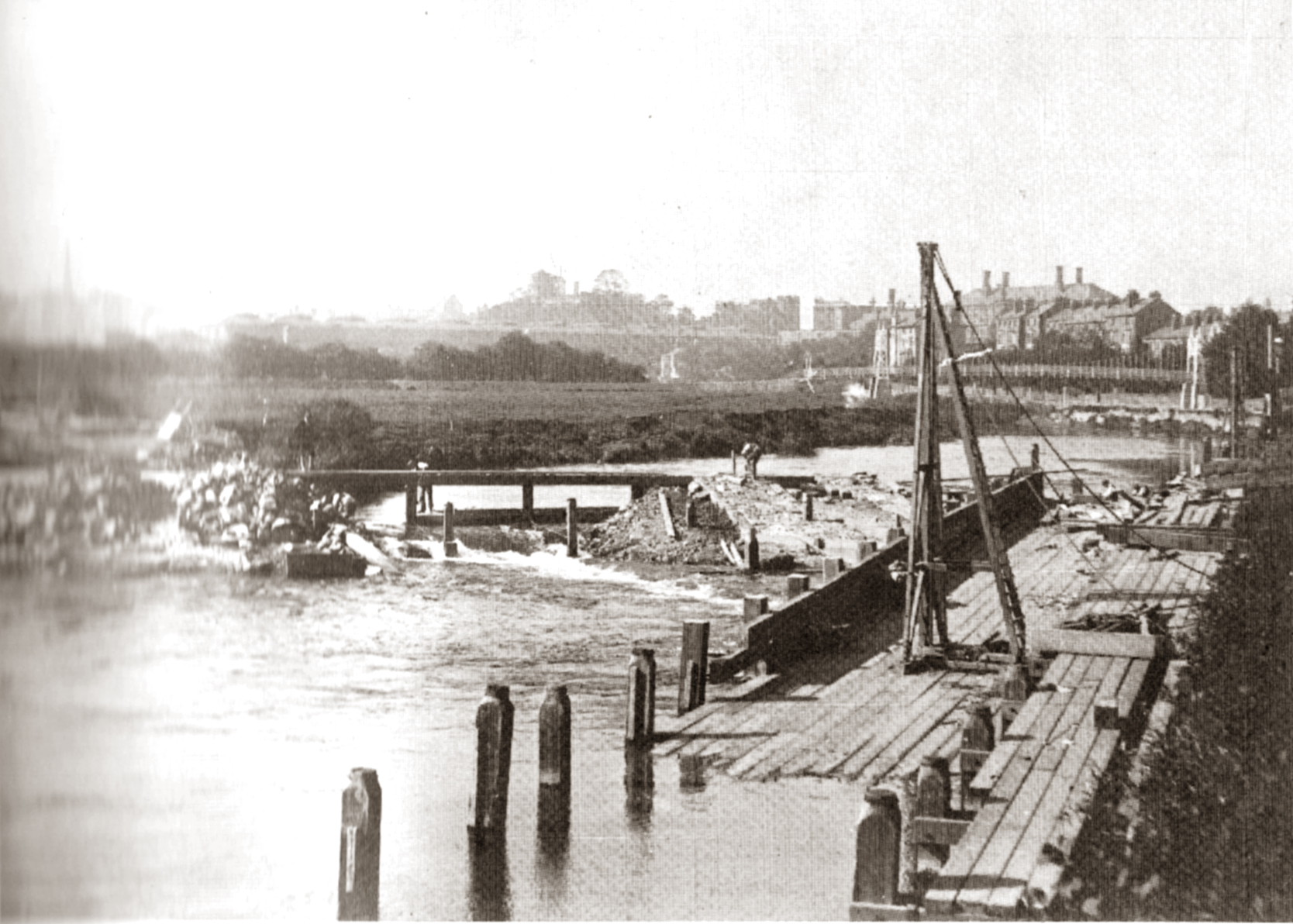
Despite the many safety warnings there are, and always have been, plenty of mainly young people walk the weir and swim above and below it when the weather is hot enough. Needless to say that sadly, there have been fatalities.
Walking the Weir, 1959
Before the weir was built and sited just below its present base was a horse ferry which carried heavy goods as well as their means of transport between Underdale Road and Castlefields. Lying on its side just down from the weir is an old post with an iron tip – the small plaque says it may be related to the old fish weir on France Island (more commonly known as Gough’s Island – see below). It is just as likely to have had something to do with the horse ferry.
RECORDING 1
The Horse Ferry

Possible remains of a horse ferry
Carry on past the Weir along Sydney Avenue, past Gough’s Island.
Gough’s Island, also known as France Island on some maps, was quite possibly man-made by digging out an additional channel for the river to create fishing opportunities probably using nets. It also appears that there may have been a woollen mill on the island operating between the 1790s and 1820s ‘powered by water that was ingeniously conveyed through a funnel across the neck of the isthmus’ (Trinder, 1996: p 138). The island is privately owned and is connected to the bank on the far side by a bridge that has been replaced on more than one occasion. Originally it was part of St. Winefride’s on Underdale Road but was sold along with a plot of land on which a new house was built. The owners briefly kept alpacas on the island.
Carry on along Sydney Avenue until the road takes a sharp left turn. At this point go through a metal wicket gate onto a footpath beside the river until you come to a substantial road bridge which carries Telford Way over the river.
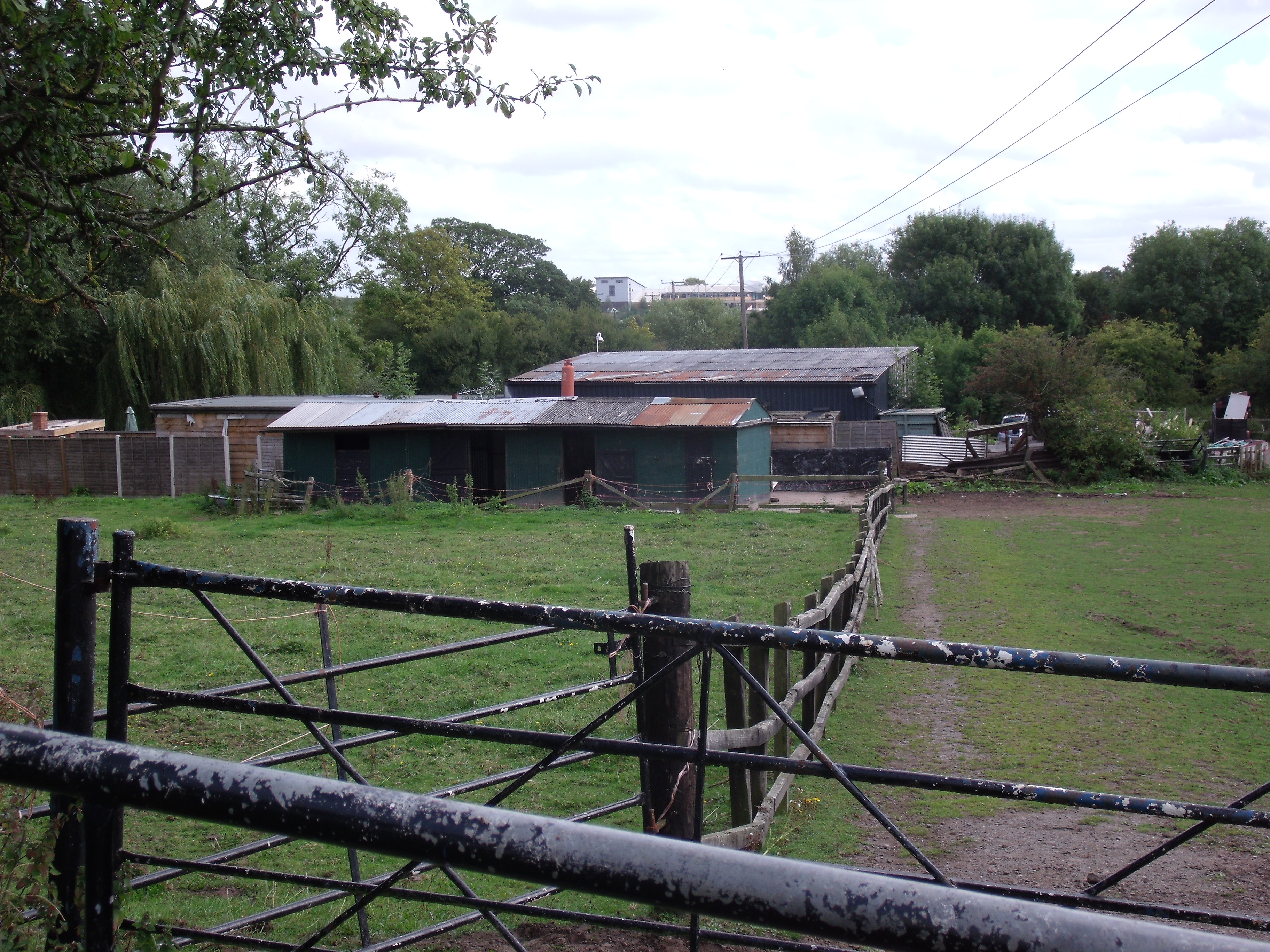
Dorset Pools farm buildings
If you carry on under the bridge the path ultimately becomes very wet and muddy as you go through an area of ditches and springs. Turn left at the bridge ignoring the steps up on to the road and walk along a path/track that can become muddy until you see an underpass on your right. This will take you under the road. Roughly where the Dorset Fishing Pools buildings are now was once New Park, a farm house and outbuildings. Follow the tarmac track round to the left and up a rise to the top. You are now directly on the route of…
The Shrewsbury to Newport branch of the Shropshire Union Canal – the first transport revolution

The Shrewsbury and Newport Canal
The Shrewsbury and Newport Canal, authorised in 1793 with the main line from Trench to Shrewsbury being fully open by 1797. It remained isolated from the rest of the canal network until 1835, when the Birmingham and Liverpool Junction Canal built the Newport Branch from Norbury Junction to a new junction with the Shrewsbury Canal at Wappenshall. At this point the canal was enlarged to be able to carry narrow boats as well as the original coal ‘tubs’ that it had first been designed for. After ownership passed to a series of railway companies, the canal was officially abandoned in 1944. Many sections have disappeared, though some bridges and other structures can still be found. There is an active campaign to preserve the remnants of the canal and to restore the Norbury to Shrewsbury line to navigation. For further information go to http://www.sncanal.org.uk
RECORDING 2
If you want to extend your walk you can turn right at this point and follow the route of the canal. Some of it has been partially dug out to create a wild live haven, other sections have been cleared of larger trees in optimistic anticipation of the canal being reopened. This path will take you right up to Uffington – not far from the bottom of Haughmond Hill.
For our walk, though, you need to turn left, and at the road go a little to your right and cross at a traffic lighted road crossing. Follow a broad pedestrian track for a few hundred metres until you get to Ditherington Road and…
The Coach (formerly The Comet) pub – the road route from the north into town
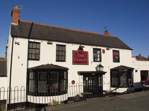
The Coach (formerly The Comet)
The Coach was originally called The Comet which took its name from a stage coach company that probably had runs to Birmingham and London.
The pub is seemingly set below the road with steps down to it. In reality, it is the road that has been built up. This road was originally known as the Causey (Causeway) and from as far back as the 1500s the Town Corporation was spending money trying to stabilise this major turnpike route into town from the north which passed over marshy ground made wet by the many springs in the area – hence the name Spring Gardens.
RECORDING 3
The road crossed the canal at this point over the hump-backed ‘Comet Bridge’ as part of a diversion from the original planned canal route. The diversion took the canal past the soon to be built Flaxmill site. No doubt the developers of the Flaxmill – William Marshall, the Benyon Brothers and Charles Bage – contributed to the costs of the final stretch taking the canal, via their Flaxmill, into Shrewsbury.
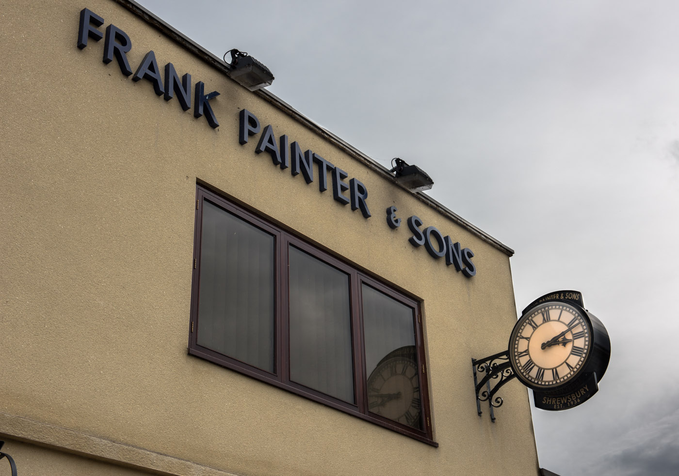
Frank Painter’s Funeral Directors
Keeping to the left side, walk down the road (Spring Gardens), go straight over the mini-roundabout with the new housing estate on your left and carry on past Frank Painter’s Funeral Directors.
On the other side of the road stood, until recently, the Arriva Bus Depot (formerly Midland Red). All that is left now is some cleared ground and a large pile of rubble. The forlorn sign bearing the logo of the CIU (Club and Institute Union) and the words ‘Midland Red Social Club’ is destined to be preserved in the Flaxmill interpretation centre. The location was an awkward one and at around 6pm each evening you used to be able to witness skilled ‘parker uppers’ driving buses forward and out into the road and inevitably halting traffic before reversing skilfully into the garage or the nearby parking lot. The site was cleared as part of the developments associated with the Flaxmill-Maltings. The depot has moved up to Battlefield but the loss of the social club was felt keenly by many members of the community. During the war, the Depot was used as a factory to construct wings for Spitfires – it was one of a number of diversified manufacturing plants set up after the main factory in Castle Bromwich was recognised to be under threat from bombing.
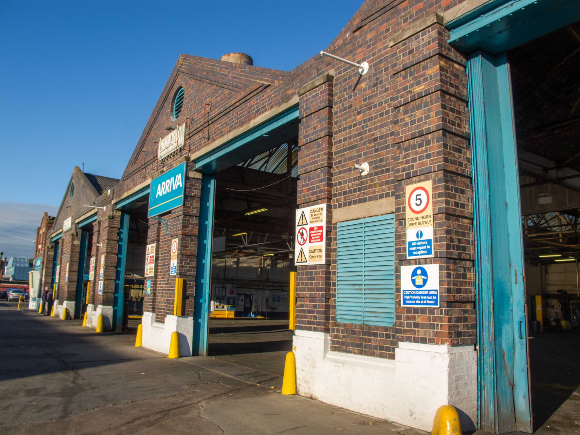
Arriva Bus Depot, 2010

Midland Red Bus Garage 1925
… and cross Sultan Road at another mini-roundabout. Spring Gardens has now morphed into St. Michael’s Street. Cross the road at a traffic-lighted road crossing, turn left and walk up to Marshall’s Court at the corner of the Flaxmill-Maltings. Turn right into Marshall’s Court.
The Flaxmill-Maltings – heavy industry comes to Shrewsbury
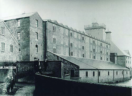
The Maltings and old factory bridge
Another walk (Walk 2) highlights ‘work industry and trade’ and covers most aspects of the Flaxmill, which later became the Maltings. For this walk it is the canal tha
t went right in front of the main mill that concerns us. The canal ran along the front of the visible remains of a long lean-to shed. This was built during the Maltings phase (1897-1987) on top of where the Flaxmill’s steam engine boilers had been housed. Coal from the boats or tubs could have been delivered directly to the place where it was needed.
If the building is open, go in and have a look at some of the illustrations on display.
The canal provided an easy means to bring in coal for the Flaxmill steam engines and the drying and bleaching processes as well as allowing the ‘export’ of linen yarn. The Flaxmill was built in 1797 – nearly fifty years before the coming of the railways and just would not have been a viable proposition without the canal. From the Flaxmill, the canal went under a road which crossed it with what was originally a traditional hump-backed bridge. This was replaced in 1913 by a flatter bridge known as Factory Bridge – later on when you re-cross the road you will see a plaque on the wall marking the site of the bridge.
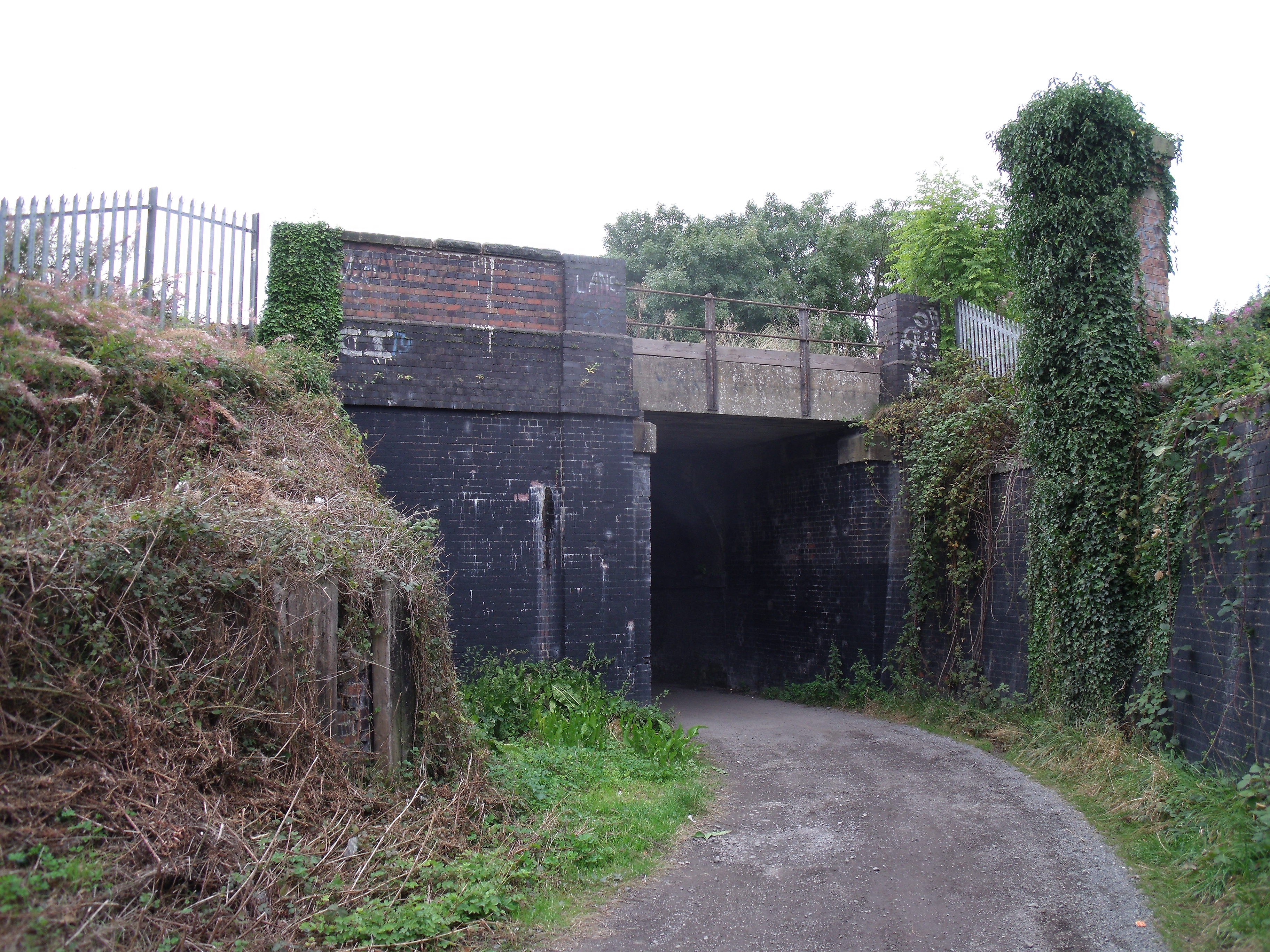
The Shrewsbury-Crewe railway bridge
Walk down Marshall’s Court and turn right down an unmade track with the Flaxmill-Maltings buildings above you to your right. At the bottom of the track you will go under a railway bridge.
The Crewe and Shrewsbury Railway was owned by the London and North West Railway (LNWR) company, built to connect Crewe with the jointly-owned Great Western Railway (GWR) Shrewsbury and Hereford line. The line was approved in 1853 but planning difficulties in accessing the GWR station at Shrewsbury delayed opening until 1858. It was so successful in transporting coal from South Wales and finished goods to the North West that it was double tracked by 1862. The line now forms the northern section of Network Rail’s Welsh Marches Line. A little further up the line there were sidings coming off into the Flaxmill-Maltings. The canal was used less and less until it finally closed in 1944. In the later stages of the Maltings phase, only coal was delivered by rail – everything else came and went by road.
RECORDING 4
After the railway bridge, ignore the track to your right (which takes you up to a caravan park) and take the right fork of the path in front of you. After 50 metres or so look to your right and you will see…
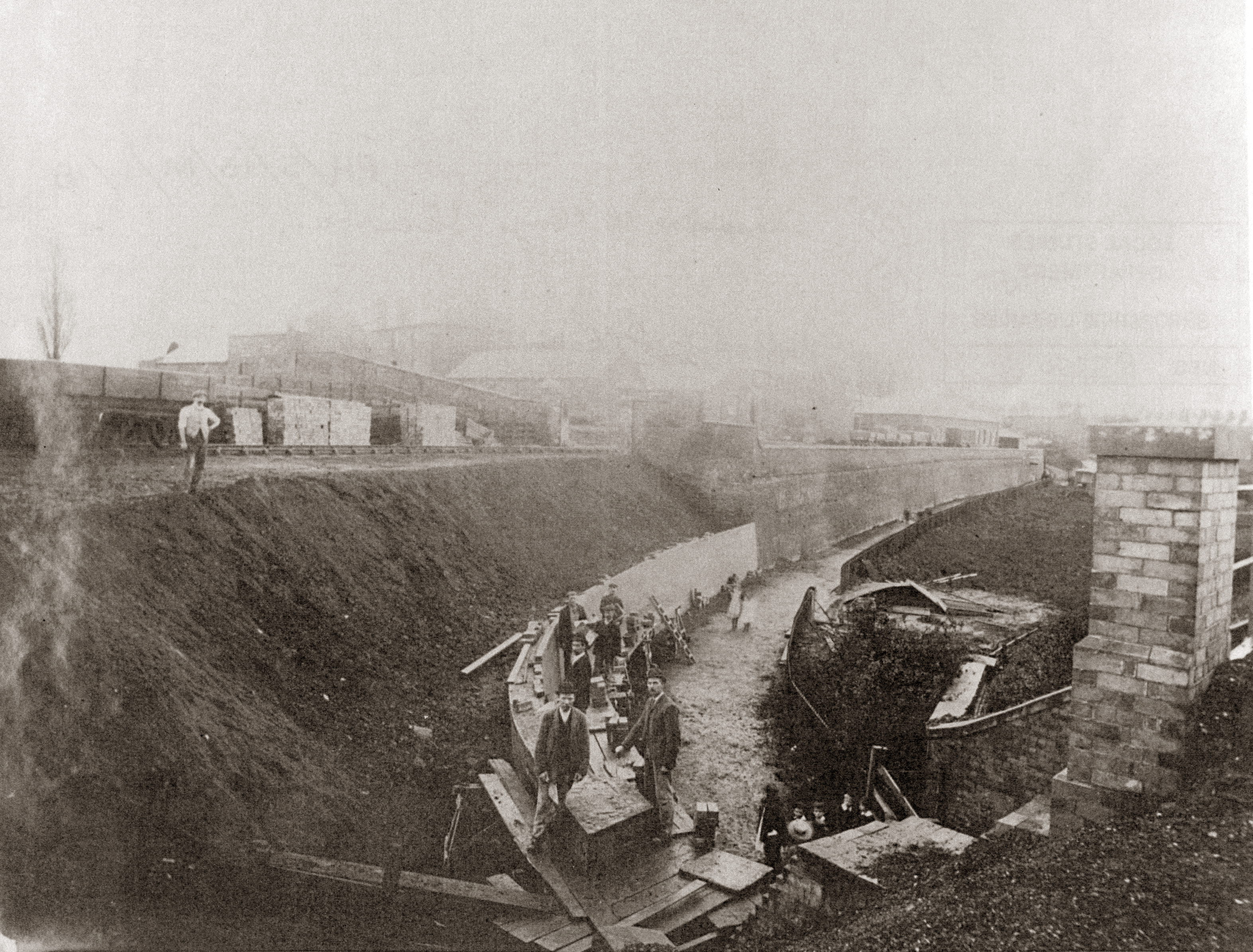
Rebuilding the bank by the Maltings sidings looking from the railway bridge, c.1920

Factory Bridge looking towards the Maltings
The Old Riverbed – indicated by the presence of wetland plants such as bullrushes
The canal passed under New Park Road
(the bridge is now demolished)
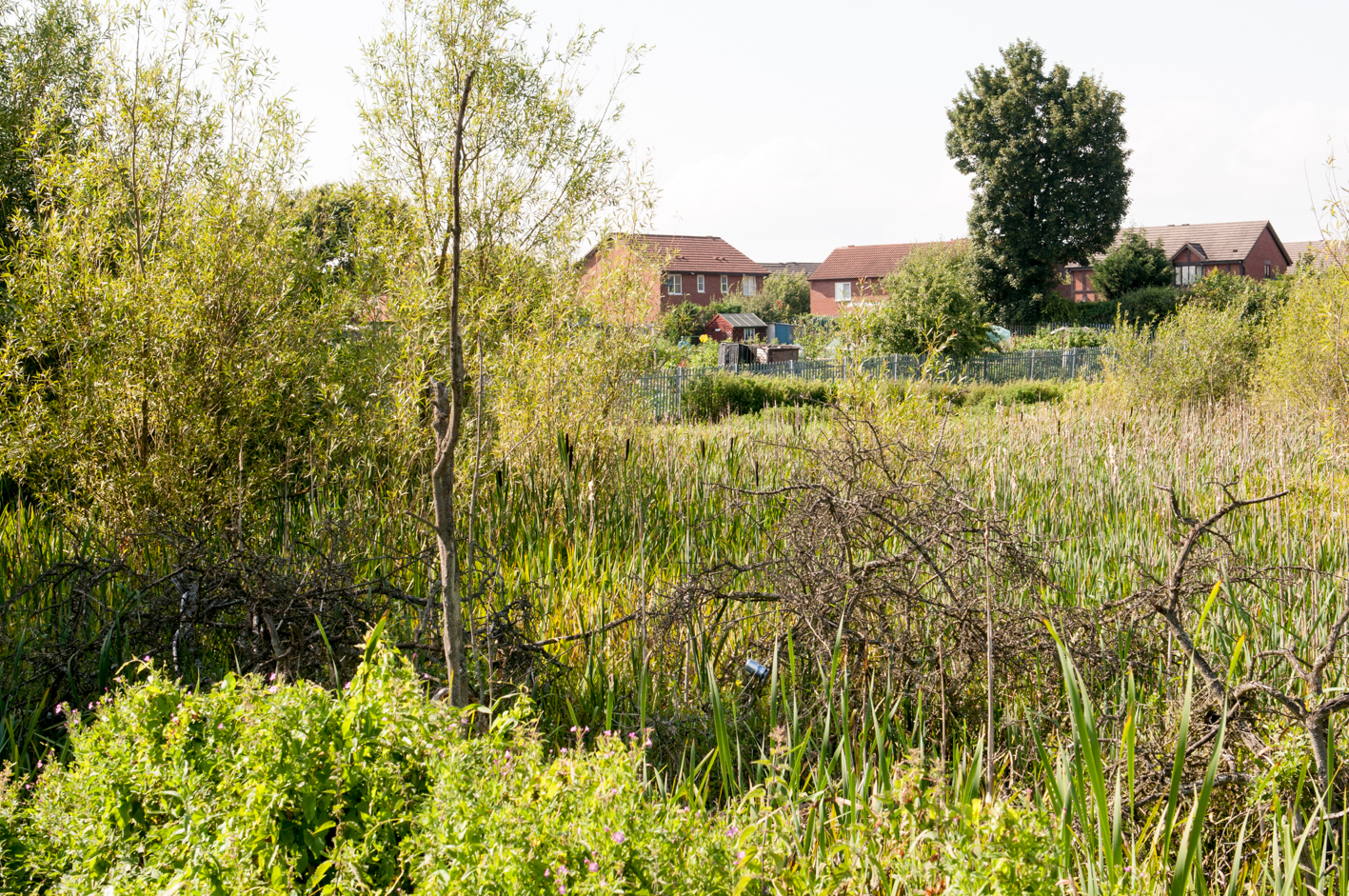
The old riverbed area is designated as a Site of Special Scientific Interest (SSSI). This section of the River Severn was cut off from the main course of the river following the last ice age about 5,000 years ago. The Old River Bed is of particular value for the extensive sedge fen which now fills this cut-off meander of the River Severn.
Wetland plant species found at the Old River Bed include lesser pond-sedge, common reed, great reedmace, water horsetail, meadowsweet; soft rush, sharp-flowered rush, water avens, bottle sedge, brown sedge and marsh cinquefoil.
Now retrace your steps back up to the Flaxmill and St. Michael’s Street. Cross the road by the hairdresser’s or go back to the traffic lights if the road is busy. To the left of a house set at an angle to the road there is a metalled cycle/pedestrian path. Note the plaque marking Factory Bridge No.47. You are now on the route of the Shrewsbury canal as it makes its half-mile way towards its original terminus known as the Coal Wharf.
The Old Riverbed
Most of the area to your right was at one time a brickworks, which almost certainly supplied bricks to build the Flaxmill.
Just before this path joins New Park Road (or Gas House Bank as it was known locally) you come across the back of The Canal Tavern with its now partly built over wharfage. Besides welcome alcoholic refreshment and food, there was stabling here and also rooms for the night, though one assumes boat people would have slept on their boats. To your right and on the other side of the fence was wharfage relating to the Castle Maltings and Brewery.
The canal passed under the road and entered an area known as the Coal Wharf – now occupied by Morris Oils at one end, and a post office/public car park at the other.
Walk up to the end of the path and turn left in front of the recently built ‘Canal Cottages’ to have a look at the front of…
The (now closed) Canal Tavern
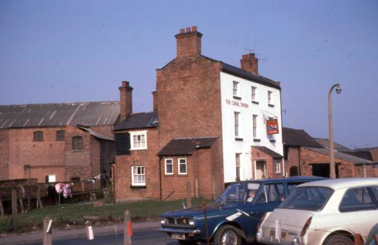
The Canal Tavern, 1976
The Canal Tavern, which was called the Navigation Inn until at least 1837 was built soon after the completion of the canal in 1797. It is still there and is a listed building and, though occupied, is no longer open. Its ‘public bar to one side of the entrance and saloon bar to the other’ layout was typical of the nine or so pubs that were once in the area. It had darts and dominoes teams and a piano in the corner.
It had guest rooms above and in later years the stabling/hay store area to the side served as a coal store. There are plenty of stories of boys being paid a shilling to pick up a sack of coal in an old pram.
Cross the road, turn right and go down New Park Road (or Gas House Bank) past entrances to Morris Oils on both sides of the road.
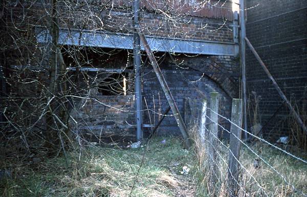
In the Morris Oils yard to your left, hard up against Beacalls Lane was once a warehouse that stored bananas brought in by rail. Once in a while the doors were left ajar and adventurous boys would nip in to pinch some fruit, though mindful of large (and maybe poisonous) spiders.
RECORDING 5
Banana warehouse
Before turning left on to Castle Foregate at the bottom, glance to your left to see the ornate offices of the Shrewsbury Gaslight Company.
Beyond this were the town’s gasworks and gas holders. On the opposite side of the road, there is a high pavement which was once the base of numerous coal ‘offices’. These were actually small sheds which were the administrative front for the extensive coal bunkers beyond and to the right of the ‘Brymbo’ cast iron bridge. It’s all a bit fenced off now but you can still catch a glimpse of the bunkers and a crane if you find a gap.
Walk on past the former Corbett’s Perseverance Ironworks (note ‘Speed the Plough’ painted under a parapet, now richly decorated as Morris Oils) and past the Britannia Inn.

The Perseverance Ironworks, now Morris Oils
There are stories of cattle being herded along Castle Foregate on their way to the Smithfield Road market and occasionally escaping up side streets such as Britannia Passage.
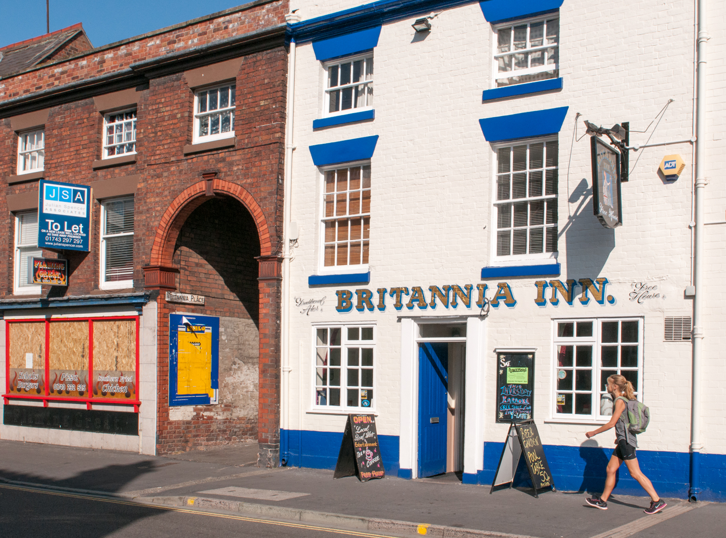
Britannia Passage
After the Royal Mail sorting office, which is due to relocate in due course, cross the road at the bottom of Howard Street and walk under the broad railway bridge (of which more later) to arrive at…
Shrewsbury Railway Station – rail expansion over the river
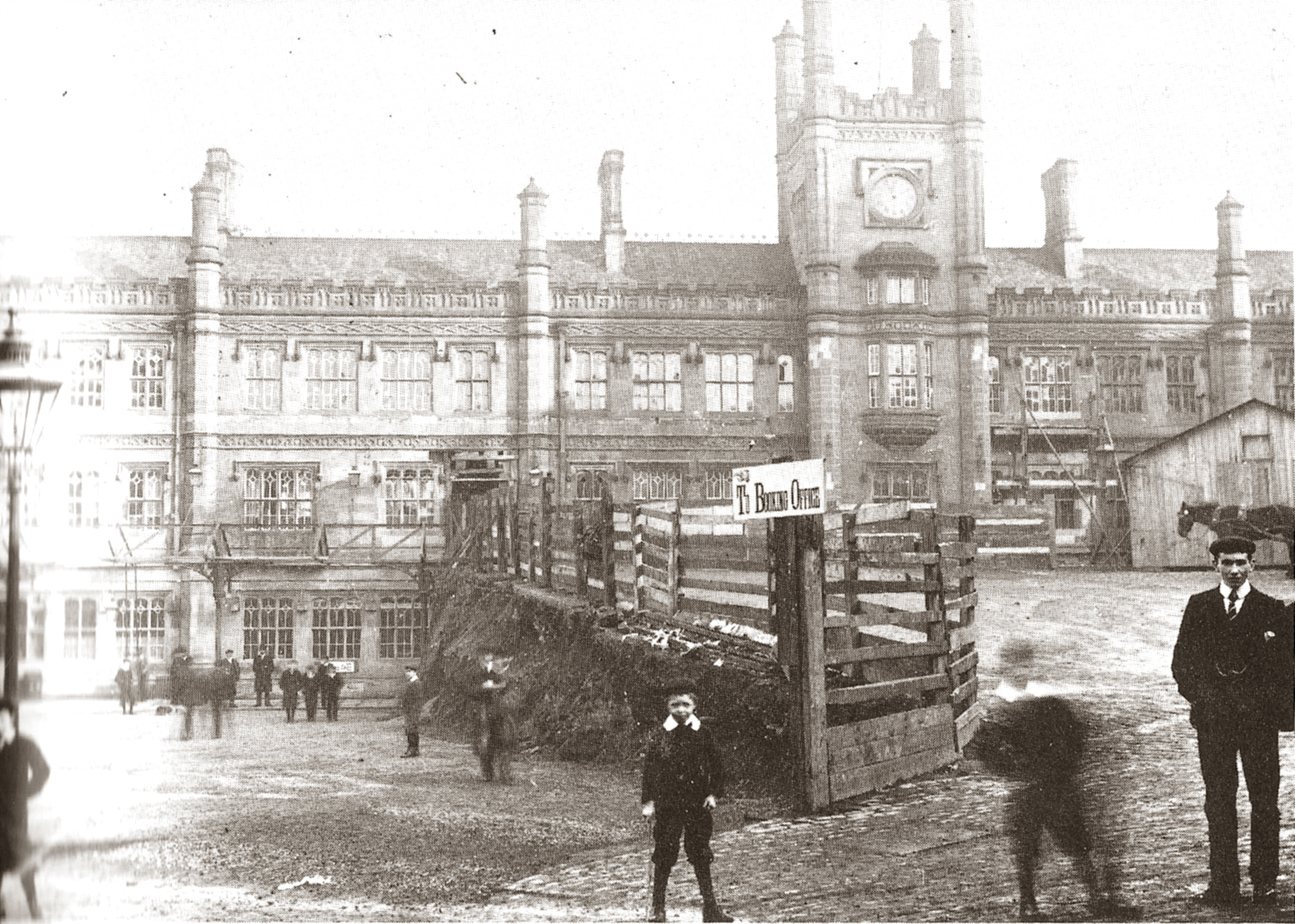
Railway station c.1901 half way through
forecourt excavation
The station was built in 1848 as a joint station used by four companies. By the end of the 1800s railway goods and passenger traffic had grown rapidly and the companies, needing more space, had to choose to rebuild or relocate. They chose the former and in 1901-2 the forecourt was excavated, taking it down approximately three and a half metres. Along with the extra space it also allowed the creation of a subway thus doing away with the need for passengers to walk across the tracks. Around the same time extra platforms were added, which were supported by additional steel bridges to either side of the original stone and brick bridge spanning the river Severn below.
On 15th October 1907, the overnight Manchester to Bristol mail and passenger express took the 10mph restricted curve approaching the platforms at Shrewsbury station at 60mph. It passed the signals set to danger, making disaster inevitable. The train was wrecked costing the lives of 18 people. The cause of the accident was never clearly established, though the engine driver and stoker being asleep was not ruled out – both were killed in the crash.
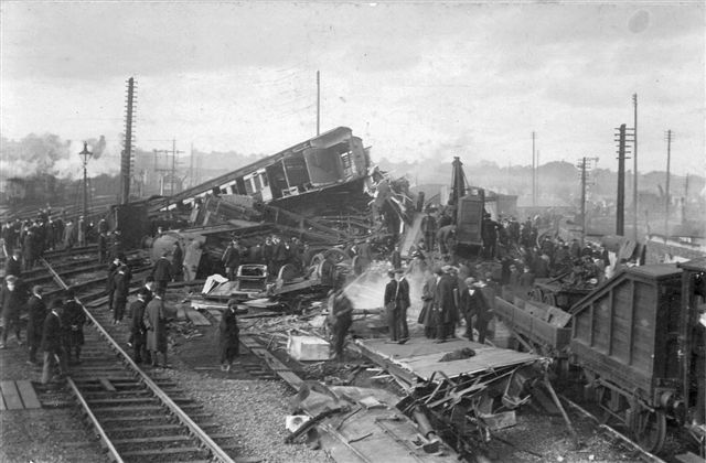
1907 train wreck
Look to your right and you will see a stone ramp behind the taxi rank, starting almost on Castle Gates. Go up this ramp, the top of which is at the original level of the station forecourt, and you come to an ornate gate that leads directly on to platform 3 (it’s usually locked). Now climb the steps until eventually you meet the Dana.
The Dana Footbridge leading to the prison
This was named after its designer, the Rev William Dana (the two a’s are short as in ‘manna’) who originally set out a promenade walk around and below the Castle many years before the arrival of the railway.
RECORDING 6
At the top of the steps turn left to take you over the Dana footbridge and bring you down opposite the prison, or gaol as it is described in early maps. The Prison is now closed and is due for redevelopment. There is more about the Prison in Walk 4. Cross the road heading to your left to the beginning of Beacalls Lane and walk over a small patch of grass to an iron parapet. You will find yourself looking at…
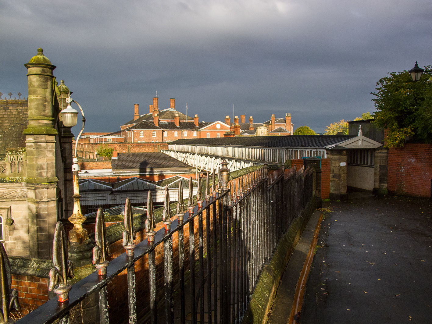
The Buttermarket and the former Coal Wharf – infrastructure that followed canal and rail development
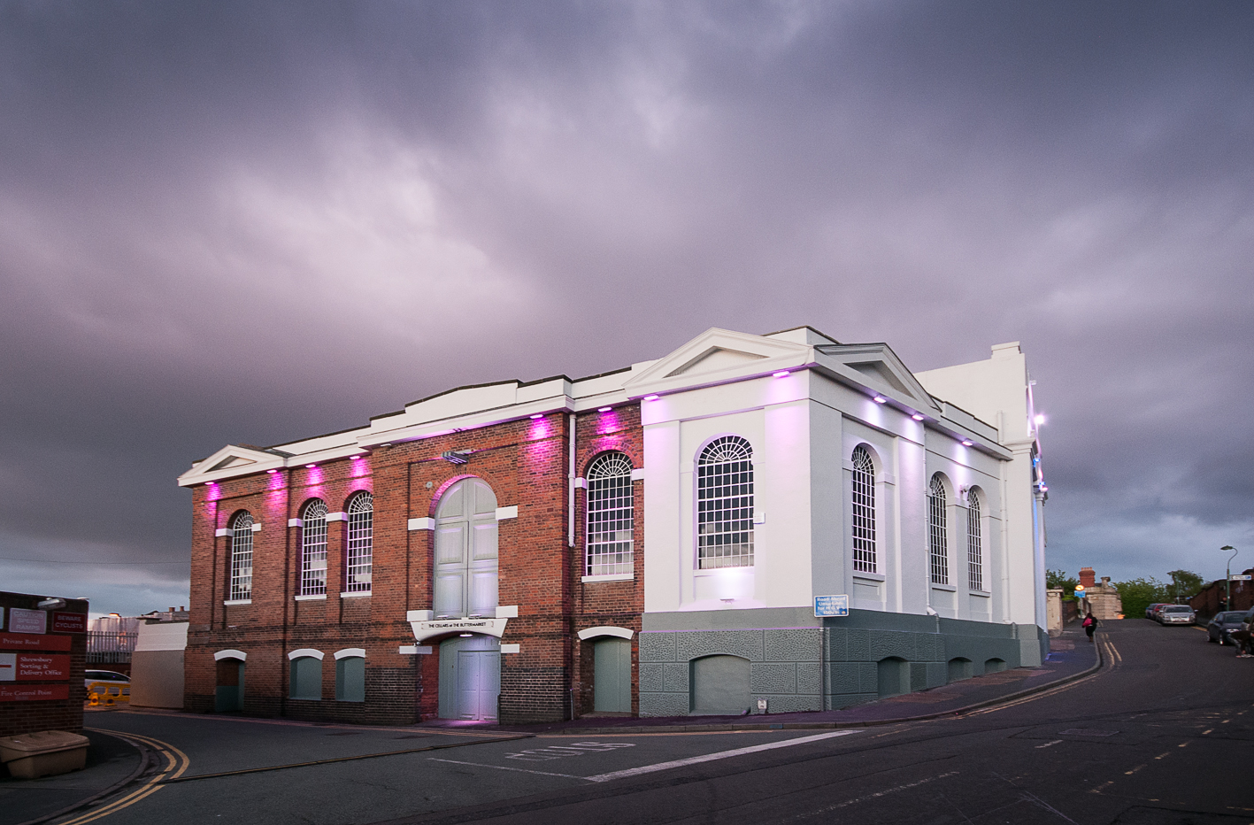
The Buttermarket
For most of its life the Buttermarket has been known more prosaically as the Howard Street Warehouse. Built in 1835, it was designed to allow the canal to come right into it from the rear, and the entrance at the front was wide and high enough to allow horse drawn wagons. It was not long before the canal trade reduced significantly and general railway related warehousing replaced cheese and dairy products trading, which moved over to the town’s new market hall in 1869. In the 1930s the Buttermarket housed a bottling plant for Holts mineral water. Most recently and after a makeover or two the Buttermarket has become a musical entertainment venue with a genuine restored Wurlitzer organ that rises majestically (how else?) from the floor.
The canal was eventually truncated to allow railway sidings and an extended coal wharf. It was no coincidence that the location of the town’s gasworks – which used coal in large retorts to create its gas nearby – was between Castle Gates and New Park Road.
Glance down Howard Street, or take a short wander down if you like, and you will see a gate to your left. Beyond the railway line in front of you is a high wall (from inside the station this is opposite Platform 7). This is where cattle or sheep were taken out of, or loaded into, railway wagons on market days. The wall prevented any straying on to the rest of the station by providing both a visual and physical barrier (the gaps were filled by hurdles).
RECORDING 7
Retrace your steps back to the end of the Dana Footbridge.
Note the sign that says ‘this is not a public right of way’ – Network Rail allow pedestrian passage across the bridge as a ‘permissive route’ which could technically be withdrawn or closed at their discretion. At one point Beacalls Lane was also a private road under the jurisdiction of the Prison Governor and it was regularly closed at night – this may have had something to do with prison security.
Walk on a few metres until you come to the former staff car park for the Prison. Step over the chain and make your way to the back iron parapet and take a look over it.
Below you will see the station and above it, the Castle. A painting from the early 1800s shows the scene before the railway was built. Laura’s Tower is plainly visible and below it was the original Lancasterian School which had to relocate to the Castlefields side when the station was constructed.109 houses were demolished on Castle Hill, Howard Street and Castle Foregate to make way for the railway and 356 people were displaced including one Mary Whitehouse. Like her latter day namesake, she was a prominent and outspoken objector. Unlike her, though, she was a prostitute who employed foul language to gain attention for her cause.
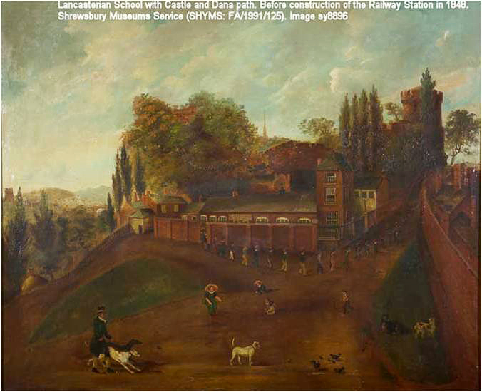
What lay beneath the Castle before the railways
Return back over the chain and look to your right where you will see the top of some steps. Go down the 59 steep steps to arrive at the river but on the way about half way down look through the under and overgrowth and try to make out a level terraced platform area. This was the base of the Railway Workers’ Social Club. You will need some imagination to visualise it – there are no photographs, just a few hazy memories. In the 1900s there were around 150 people employed in and around the station and the majority of them, according to Census material, lived in Castlefields.
You are now on the river towpath. Walk to your right until you are under the bridge that carries Shrewsbury Station’s platforms over the river.
RECORDING 8
You may well hear the heavy rumble as trains pass over head. There have been occasions when musicians have used the acoustics to spectacular effect – you could always try a song, or just a shout or a whistle yourself. Anyhow, you will see straight away that what appears at a distance to be one wide bridge is in fact made up of three bridges. You don’t have to be a structural engineer or industrial archaeologist to work out which one is the oldest. Also you don’t have to be a birdwatcher to know that this is the haunt of pigeons so watch out for droppings!
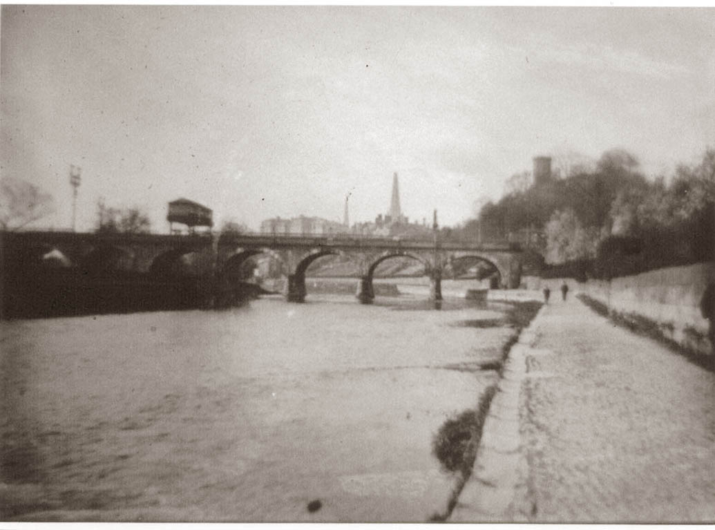
The river and the stone railway bridge, 1864
Retrace your steps past the bottom of the steps and on towards Castle Bridge, or the Blue Bridge as it is more commonly known, locally.
On your way take a look at the photograph of the (single) railway bridge as it was in 1894. We know it was taken then because the spire of St. Mary’s is missing its tip. It blew down in a gale, which the vicar preached was God’s wrath at certain Shrewsbury people planning a memorial to Charles Darwin! Note also the large signal box that traversed the line.
Just before you arrive under…
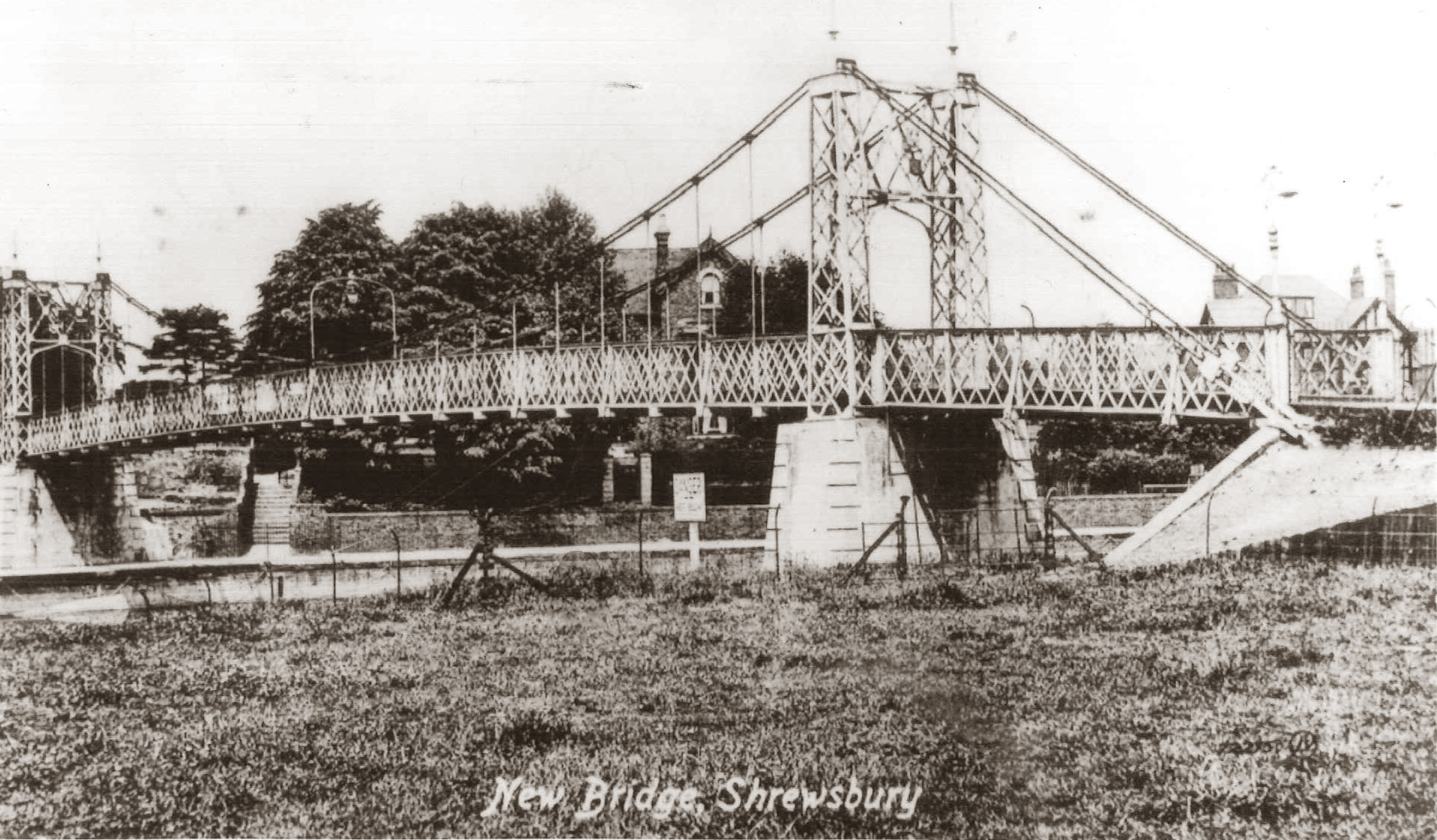
The Blue Bridge
The original Castlefields footbridge
… at the point where there is a short road up to your left and railings to your right, look over to the far bank where you should see two wooden posts in the river near to the bank.

Blue Bridge under construction, 1951

All that remains of
the temporary pontoon footbridge
This is what remains of a temporary pontoon footbridge that was constructed after the demolition of the Castlefields steel suspension bridge. It was very like the Porthill Bridge – was built in 1910, around about the same time as the weir was constructed.
The Blue Bridge (1951) which eventually replaced the temporary pontoon bridge is rather special – to quote the plaque at the Castlefields end it is ‘the first pre stressed counter balanced cantilever bridge in the country’. This fails to mention that it was also ‘post tensioned’ (ie cables inside the structure were tightened up after the bridge was installed.
It was the prototype for many of the motorway bridges that are so common today. A first for Castlefields!
RECORDING 9
On New Year’s Eve every year between around 5.00pm and 8.00pm people bring model boats with candles in them, floating lanterns or even hollowed out marrows with tea lights and lower them from the bridge or float them off from the side. The idea is that they should stay alight until they disappear over the weir where many people gather to watch. Depending on the state of the river and the wind, some years are better than others. For some it is pure fun, and for some it is a magical spectacle, while for others there is a significance relating to hopes and dreams for the coming year. It can of course be all three of these options.
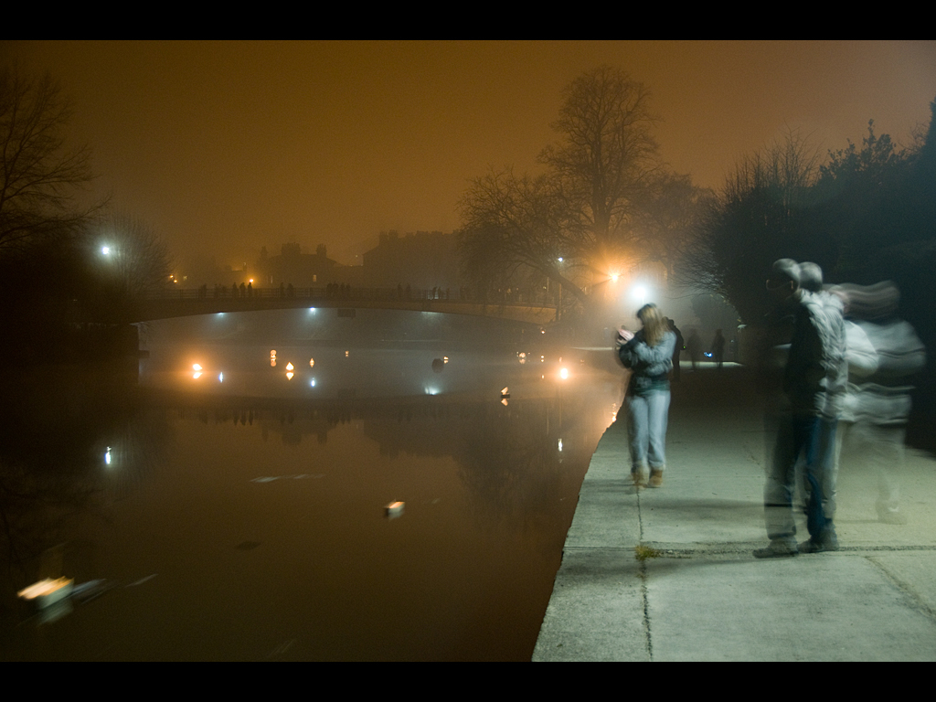
Boats with candles
From here walk along the river with the large houses of Severn Bank to your left and you will come back to the Weir – our starting, and finishing point.